• Skip to primary navigation
  • Skip to main content
  • Skip to primary sidebar
  • Skip to footer

Maine Lights Today

 Exploring the Lighthouses of Maine & more!

  • Home
  • Explore
    • Maine Lighthouse Facts
    • Maine Lighthouses Webcams
    • National Lighthouse Day
  • Light List
  • Home
  • Blog
  • About Us
  • SHOP

Burnt Island Lighthouse

Location: Boothbay Harbor
Latitude: 43°49'30.5"N Longitude: 69°38'24.9"W
Station Established: 1821
Automated: 1988
Structure Status: Standing
Tower Height: 30 Feet
Focal Plane: 61 Feet
Present Day Optic: 300 mm Lens
Historic Structures Remaining: 

1857 keeper's house

1880 boathouse

fuel house (c. 1886)

1899 oil house

Lighthouse Owner: Maine Department of Marine Resources
Lighthouse Managed By: 
Maine Department of Marine Resources

PO Box 8, West Boothbay Harbor, ME 04575
207-633-9500
http://www.maine.gov/dmr/education/burnt-island/index.html

Burnt Island Lighthouse
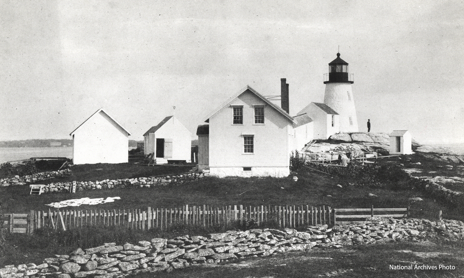
Burnt Island Lighthouse - National Archives Photo

Primary Sidebar

Follow Us On…

  • Facebook
  • Instagram
  • Twitter
  • YouTube

In our Store…

Maine Lighthouse Coloring and Activity Book Lighthouse Books by Bob Trapani and Dominic Trapani Shop Moments in Maine

Sign up for Free Video Series…

Maine Lighthouse Video Series
Enjoy the beauty of Maine’s Lighthouses from the comforts of your home or on the go….
Sign up to receive free videos, latest blog features and more!

Latest Posts…

Bass Harbor Head Light

Worlds within the Lighthouse World

Squirrel Point

Blissful Hush at Squirrel Point Lighthouse

Light on high

Light on High

Owls Head Light

Lighthouses in Time

Browse Features by Category

Footer

Connect with us on…

  • Email
  • Facebook
  • Instagram
  • Twitter

Contact Us

Maine Lights Today
published by Moments in Maine
PO Box 642 | Rockland, ME 04841
T: 207-691-8400

© 2016-2023 Moments in Maine · All Rights Reserved ·