Doubling Point: A Light’s Short Move
(Photo by Bob Trapani, Jr.)
When one pours over early historical documents related to our nation’s lighthouses, there is ample evidence that a number of lights were considered inferiorly constructed, many were poorly equipped, and still others were established in questionable locations. This was especially the case during the time period between 1820 and 1852 under the direction of the Fifth Auditor of the U.S. Treasury, Stephen Pleasonton.
In Maine, reports from the early 1800s questioned the location/navigational effectiveness of lighthouses like Dyce Head, Pemaquid Point and Hendricks Head, to name a few. In fact, some mariners and inspectors noted that these lights were all but useless and could have been decommissioned with no adverse impact on navigation.
By 1852, Congress had replaced the Fifth Auditor of the U.S. Treasury with the United States Light-House Board to oversee the operation, construction and maintenance of lighthouses. This quasi-military board, which remained in place from 1852 to 1910, was composed of highly respected naval officers, army engineers and coast survey personnel.

(National Archives photo)
During this era, the level of professionalism applied to the consideration of new sites for lighthouses, the durable construction thereof – and even the performance of keepers, was lifted to heights of efficiency previously unknown. In time, America’s lighthouses and navigational aids rose to become the finest system in the world.
However, even the best of oversight could make a mistake in judgment when it came to something like the placement of lighthouses. Doubling Point on the Kennebec River was one such rare instance during the U.S. Light-House Board’s tenure.
On a side note, it is curious as to why it took the Federal government so long to establish lighthouses along the Kennebec River in the first place. The riverbanks of places like Bath and Hallowell were thriving with important shipbuilding activities as far back as the mid-to-late 1700s.
(Photo by Bob Trapani, Jr.)
In the 1924 book, The Story of Maine: Coastal Maine, by L. Whitney Elkins, the author mentions the shipbuilding efforts, stating, “About the middle of the eighteenth century Bath turned its thoughts to building ships and in 1762 Captain William Swanton established shipbuilding as a regular business and maintained shipyards until his death. Other builders followed, and soon after the Revolution this industry made big gains.”
Elkins went on to note, “The city was prosperous and for miles along the river’s bank the yards resounded from morning to night with the blows of the workmen…In this particular work the small city on the Kennebec led all the New World and Bath-made vessels were considered the best that rode the ocean. About 1890 the Bath Iron Works – a consolidation of several lesser plants – was established.”
(Photo by Bob Trapani, Jr.)
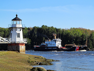
In addition to bustling shipbuilding efforts, the Kennebec River was also home to ice cutting and logging industries – not to mention the regular steamship activity that plied the waters of the Kennebec.
In 1796, the Federal government established Seguin Island Light Station, situated 2.5 miles south-southeast of the river’s entrance and a quarter of a century later, built the Pond Island Light Station near the mouth of the river in 1821.
Seguin Island and Pond Island lights were invaluable in their service to mariners, but their guiding beams were only able to safely point the way to the Kennebec River’s entrance. Once a ship entered the river, the winding way up to the City of Bath for instance – some twelve miles in distance, was devoid of a lighthouse. No additional lighthouses would be built along the river for another seventy-seven years.
(Photo by Bob Trapani, Jr.)
The Annual Report of the Light-House Board in 1892 (and again in 1893) made a strong case for a system of lights to finally be established along the Kennebec River. The reports noted, “There were 3,137 arrivals of vessels in this river during the year, not counting the steamers, which ply daily. The steamers Kennebec, 1,653 tons, and Sagadahoc, 1,143 tons, made ninety-six round trips each from Gardiner to Boston. Other passenger steamers ply on the river from Bath to Augusta, Boothbay, and Popham Beach, and intermediate places. The number of passengers carried was 232,150.”
The report went on to state, “The ice usually goes out early in April. The river not only has the sea fogs, which extend to Bath, but its own river fog or mist, which is dense and at times low down. On dark nights it is sometimes impossible to tell where the water ends and the shore begins.”
(National Archives photo)
In 1895, Congress appropriated $17,000 for the construction of lighthouses and other minor lights along the Kennebec River, which included Perkins Island, Squirrel Point, Doubling Point Range and Doubling Point.
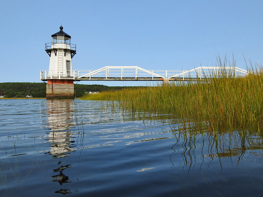
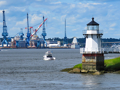
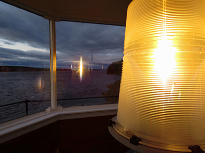
The lighthouse service completed the construction of all the lights, including Doubling Point, in 1898. Doubling Point was the last lighthouse on the river before reaching the City of Bath, and was located approximately one-half mile away from the Doubling Point Range Lights.
In an 1898 Notice to Mariners, the light station was described as: “A fixed red lens-lantern light, in the white, octagonal, pyramidal, shingled tower, with black lantern recently erected on Doubling Point, Arrowsic Island, northerly bank of the river, and near the upper end of Fiddlers Reach. The focal plane of the light is 33 feet above the water and 17 feet above the base of the tower. The light is visible from all points of approach. A square, white, pyramidal, shingled, fog-bell tower 44 feet NNW from the light tower. The bell sounded once every 15 seconds.”
(National Archives photo)
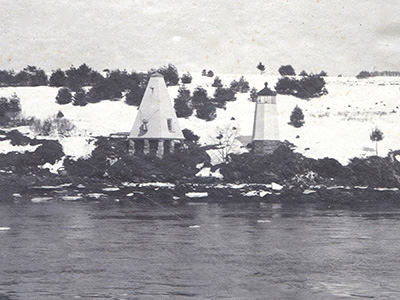
During the surveying process for establishing Doubling Point Light, the U.S. Light-House Board no doubt felt that the original placement of the aid was ideal. Indeed, its location was a commanding high, rock ledge along the upper end of Fiddler’s Reach and would have been easily seen by vessels traversing up the river, but as it turned out, such was not the case from further upriver despite what the 1898 Notice to Mariners indicated when it stated, “The light is visible from all points of approach.”
“The lighthouse could not be seen from Bath” as was noted in the Friends of Doubling Point Light’s November 2018 newsletter. This fact was especially problematic for large ships departing Bath due to the presence of a couple of shallow, ledge-laden locations that extended out into the river at Doubling Point. In addition, the fast currents on the river only served to compound the hazard. For mariners, being able to pick-up the light at Doubling Point from a distance was paramount to ensure safe passage through this area.
(Photo by Bob Trapani, Jr.)
The U.S. Light-House Board would rectify this error in the placement of Doubling Point Light about a year-and-a-half later.
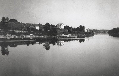
The 1900 Annual Report of the Light-House Board stated, “On September 25, 1899, the fixed red lens-lantern light at the station on Doubling Point, Arrowsic Island, northern bank of the Kennebec River, and near the upper end of Fiddlers Reach, was moved to a point 532 feet NW from its former position.”
The report went on to note, “For a few days after the above date the light was exhibited from a mast on the square, gray, granite pier recently erected near low water line at the point described above; the present tower was moved to the pier as soon as practicable and the light installed therein as heretofore. The focal plane of the light is now 25 feet above mean high water.”

(Maine Lights Today photo)
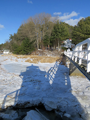
“A footbridge, painted white, connects the pier with the shore. The fog bell, with its striking machinery, was established in the base of the light tower as soon as the tower was moved to its new position. No change has been made in the characteristic of the light or of the fog bell, nor has the color of the light tower been changed.”
The move of Doubling Point Light to its present day location satisfied the concerns of mariners and it has served as an effective aid to navigation ever since. However, its new location presented another problem – this one from a structural well-being.
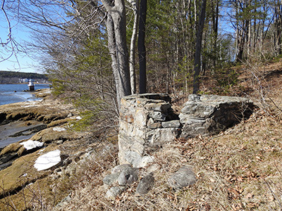
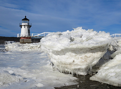
Whereas the original site of the lighthouse was atop a high rock ledge – well out of the reach of the notorious ice floes on the Kennebec River, so was not the case at the new location. The lighthouse is situated at the edge of marshland, some 130-feet from the shore, and has no protection from fast-moving ice floes that move downriver during the winter.
(Photo by Bob Trapani, Jr.)
Some years these ice floes are quite large in size and tend to drift upon the marsh area along the turn in the river at Doubling Point. Depending on the severity of the ice season, the floes pile up in impressive fashion and subsequently exert a formidable moving force against the light tower’s granite pier foundation.
“Over the decades, ice floes in the Kennebec have damaged and shifted the tower’s foundation of granite blocks,” said noted author and historian Jeremy D’Entremont in his 2009 book, The Lighthouses of Maine. “In December 1999, the tower was lifted off the foundation with a crane and placed on a barge, then moved into temporary storage at a docking facility in Woolwich. A contractor, Reed and Reed, reset the granite blocks, each weighing about six tons. After the base was repaired and reinforced the lighthouse was returned in January 2000.”
(Photo by Bob Trapani, Jr.)
This critical repair work to the base of the lighthouse was carried out by the Friends of Doubling Point Light, a nonprofit group created in 1997. The Friends raised the $50,000 necessary to complete the project and protect the lighthouse from falling into the river. The group would later rebuild the walkway to the tower and have kept the historic light station in tip-top shape.
Today, Doubling Point Light stands a firm watch along the banks of the Kennebec River, with hardly a whisper as to its one-time short move northwestward in days gone by. You might say that Doubling Point Light “dropped anchor” in sight of Bath – “The City of Ships,” during September 1899 and is staying put for many more years to come!